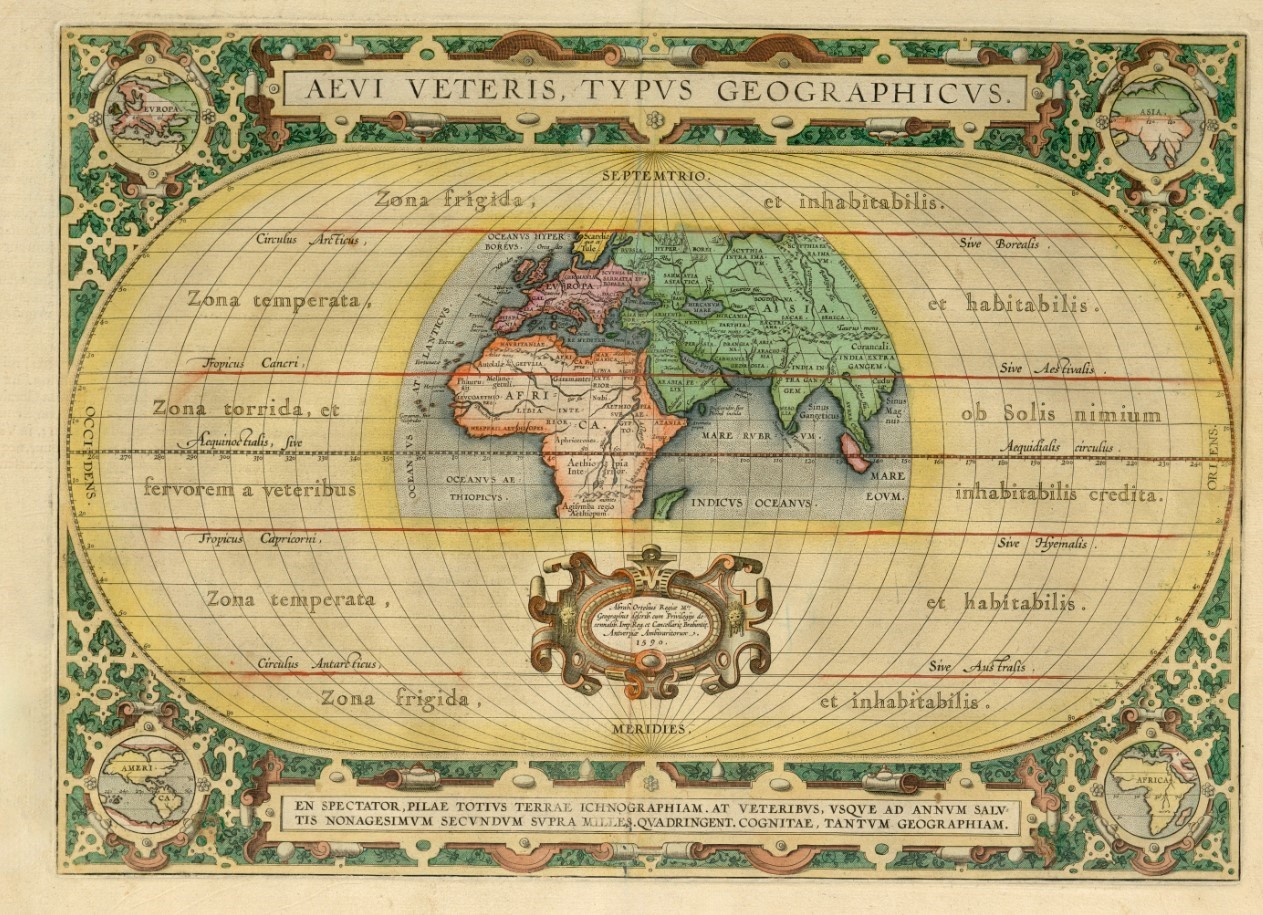
The map of the ancient world by the Flemish cartographer Abraham Ortelius, known as the father of modern cartography which was first printed in 1590 (the date of first printing is denoted on the map).
The edges of the map feature symbolic depiction of Europe, Asia, Africa, and North and South America.
On Ortelius’s map, the ancient Georgian state of Colchis (COLCHIS) is marked to the east side of the Black Sea (Pont Euxinus).