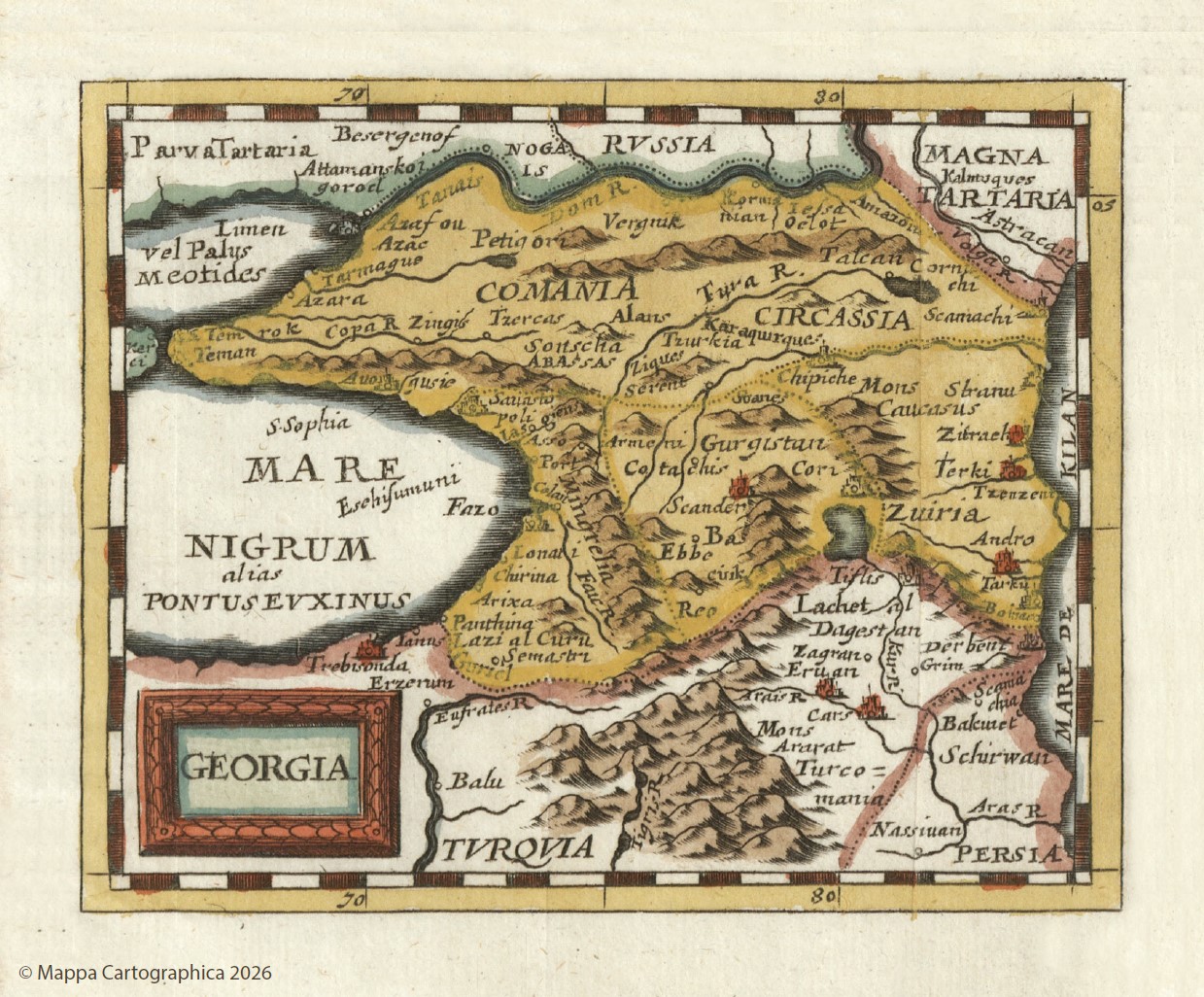
The 1681 Nuremberg edition of the famous map by the French royal cartographer Pierre Du Val. Originally, the map was published in Paris in 1670 under the title GEORGIE.
In the legend of this Du Val map, only a single designation—GEORGIA—is used, which, alongside Georgia itself, spans almost the entire region from the Black Sea to the Caspian Sea. The map features locations such as Lonati (Batumi), Fazo (Phasis), Sauastopoli (Sukhumi), Cotatis (Kutaisi), Scander (Skanda), Cori (Gori), Tiflis (Tbilisi), and others. Among the Georgian kingdoms and principalities, the map indicates Guriel (Guria), Basaciuk (Imereti), Mingrelia (Samegrelo), Souanes (Svaneti), Gurgistan (in this case, Kartli), and Lachet (Kakheti).


